Edit chart
Loading graph
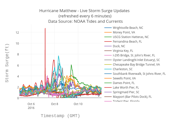
Bigdata153's interactive graph and data of "Hurricane Matthew - Live Storm Surge Updates (refreshed every 6 minutes) Data Source: NOAA Tides and Currents" is a scatter chart, showing Wrightsville Beach, NC, Money Point, VA, USCG Station Hatteras, NC, Fernandina Beach, FL, Duck, NC, Virginia Key, FL, I-295 Bridge, St. John's River, FL, Oyster Landing(N Inlet Estuary), SC, Chesapeake Bay Bridge Tunnel, VA, Charleston, SC, Southbank Riverwalk, St Johns River, FL, Sewells Point, VA, Dames Point, FL, Lake Worth Pier, FL, Springmaid Pier, SC, Mayport (Bar Pilots Dock), FL, Trident Pier, Florida, Beaufort, NC, Wilmington, NC, Fort Pulaski, GA; with Timestamp (GMT) in the x-axis and Storm Surge(ft) in the y-axis.. The x-axis shows values from 0 to 0. The y-axis shows values from 0 to 0.